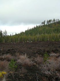
At around MP 6, there is a locked gate on the side road. We kept going for another couple of miles until we got to a huge lava flow, where we stopped to get out and take pictures. We could clearly see Lava Butte with the Cascade Range behind it. Our cell phones worked there. We kept driving slow, taking our time, until we came to a crossroad with a sign announcing it was North Paulina Road:

On the right was an unkempt dirt road, and on the left were arrows announcing Swells Wells, 12 miles and HWY 97, 13 miles. So we turned left. We figured out as we got closer, and saw off road motorcycles, that that must be Swells Wells. Gentle bumps with trails. We were speculating why it was named that in the first place. I'll need to look it up.
We ended up at HWY 97, a couple of miles north of Lava Butte, nearly at the High Desert Museum. It was about a 30 mile trip on gravel roads, and it took us around 2 hours. It was so fun to visit with Mom and Cary as we drove along, enjoying the views. Remember, you can enlarge these pictures by just clicking on them ... you will be able to see the deer better if you do.
Views looking down the road:


*******************************


*******************************
Views of the lava flow and trees, up Fish Hook Road around 8 miles or so:


*******************************
 The hill when we got to it on the other side of the loop.
*******************************
 Lava Butte from around MP 8 from on the loop.


